What is Prahistory
Around 1400, Prague was one of the largest cities north of the Alps. Emperor Charles IV had been dead for twenty-two years, his New Town was only half a century old, the stone bridge was still being finished and Jan Hus had not yet begun to preach. Of that city, what we see today is mostly its towers, its churches and the plan of its streets.
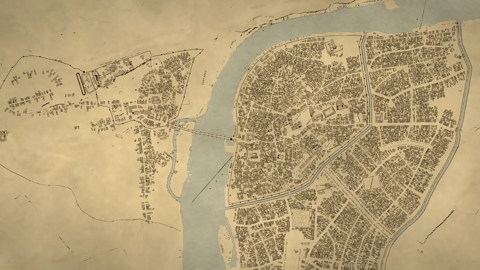
Prahistory builds that city back, whole and in one piece: Hradčany, the Lesser Town, the Old Town and the New Town. It holds around 13,000 houses, courtyard and farm buildings, more than a hundred churches, monasteries, gates and other landmarks, and over a thousand buildings in the surrounding villages. The terrain, the Vltava and the bridge rest on surveyed data from IPR Praha, the city’s planning institute. The landmarks are based on more than eighty research notes on individual buildings, where every claim carries a label: documented, inferred or probable.
It is a probable picture of the city, not an exact copy. How each building looked, how they were laid out and what the terrain was like back then can no longer be known in full. Prahistory shows what could be found in historical sources, archaeology and survey data, and says so where we are not sure.
You are not a spectator. Walk down Celetná Street, look across from Kampa at the unfinished bridge, click on a church and read what it looked like in 1400.
Frequently asked questions
What is Prahistory?
Prahistory is a reconstruction of the whole of Prague around 1400 that you can explore right in your browser. View the city from above like a map, click on a church, gate or bridge to read what we know about it, then step down into the streets and walk them in first person.
Do I need to install anything or sign up?
No. Prahistory runs in an ordinary web browser (Chrome, Edge, Firefox, Safari) with no installation and no account.
What works best, and how long does it take to load?
It works best on a desktop or laptop computer with a mouse and keyboard. Loading takes about half a minute: the city is built inside your browser when you open it, downloading roughly 40 to 80 MB of data.
Computers with less than 8 GB of memory or older graphics may struggle. Phones and tablets are not reliably supported yet.
Is the city itself in English?
Not yet. This page is in English, but inside the city the on-screen hints and the research notes on buildings are in Czech for now.
How do I get around?
On the map, drag with the mouse to move, use the scroll wheel to zoom and the right mouse button to rotate and tilt the view. Click a building to open its panel with research notes.
The “Sejít sem do ulic” (go down to the streets) button in the building panel, or the Tab key, takes you down to street level. There you walk with W, A, S, D, run with Shift, look around with the mouse and return to the map with Tab. The N key shows the city plan.
How accurate is the reconstruction?
Prahistory is a probable visualisation of Prague around 1400, not an exact copy. The exact appearance of the buildings, their layout and even the terrain of the time can no longer be known down to the last detail; we show what could be found.
The terrain and the bed of the Vltava come from present-day survey data, adjusted to what we know about the state of things back then (town moats, river banks), and may still differ from reality in 1400. Churches, gates, town halls, monasteries and other landmarks follow research on each individual building; each one’s panel gives a summary and links to sources.
Ordinary townhouses are typical rather than individual: they reflect how people built in Prague around 1400, not a specific house on a specific plot.
How is Prahistory made?
Prahistory is a vibe-coded project: its code, 3D building models and research are made together with artificial intelligence. The author sets the direction, checks and decides; the AI writes the code and looks up sources. That is why every claim in the research notes says how well it is documented and links to its source.
Where do the data and sources come from?
We compute the city surface and the riverbed ourselves, but they are built from the ground up on open data from the Prague Institute of Planning and Development (IPR Praha, licensed under CC BY 4.0), which we adapt to their state around 1400. Our own model of Charles Bridge is also measured from the IPR survey. The historical appearance of buildings is assembled from scholarly literature, archaeological research and old maps of Prague, including Václav Vladivoj Tomek’s History of the City of Prague and the city plans by Herget and Jüttner.
Why the year 1400?
By 1400, Prague had the great building projects of Charles IV behind it: the New Town, founded in 1348, was half a century old, the stone bridge (today’s Charles Bridge) was being completed and St Vitus Cathedral was rising. It is also Prague on the eve of the Hussite Wars: Jan Hus would only begin preaching at the Bethlehem Chapel in March 1402.
What is still missing?
Above all, life: people, animals, carts and the sounds of the city. That is being worked on right now, and we will see how it goes. More centuries and historical eras of Prague are planned as well.
Who is behind it
Prahistory is made by Martin Richter, co-founder of Aignos, a non-profit focused on AI education, and of Poznatek, which works on education and digital projects. He teaches the course AI in Communication at the Faculty of Social Sciences, Charles University.
Prahistory is a vibe-coded project, made together with artificial intelligence.
Cross the threshold
Prague in 1400 is built right in your browser.